|
No |
Title and Author |
Page |
|
1 |
Applying a two-dimensional open-source hydrodynamic model to evaluate the riverbed change in the upstream of the Cuu Long River, An Giang province Luu Van Ninh1,3, Nguyen Huu Tuan2,3, Ngo Chi Tuan3, Le Ngoc Anh4, Nguyen Tien Giang3, Can Thu Van2* 1 An Giang Provincial Hydro-Meteorological Center; luuninhtv@gmail.com 2 HCMC University of Natural Resources and Environment; nhtuan@hcmunre.edu.vn; ctvan@hcmunre.edu.vn 3 Hanoi University of Science, VNU; giangnt@vnu.edu.vn; ngochituan@gmail.com 4 Vanlang University; anh.lengoc@vlu.edu.vn *Corresponding author: ctvan@hcmunre.edu.vn; Tel.: +84–983738347 Abstracts: Riverbank erosion in the Mekong Delta, particularly along the Tien and Hau rivers and some primary and secondary tributaries, is undergoing highly complex and unpredictable changes, resulting in significant damage to the affected areas. The phenomenon of riverbank erosion here is caused by multiple factors, including intensified human activities such as sand mining, infrastructure development, and climate change. In recent years, the increasing activities of upstream Mekong River projects have led to a reduction in sediment deposition in the delta, which is considered one of the significant contributing factors to the increasing incidence of riverbank erosion. This paper will apply and build a two-dimensional open-source model (TELEMAC) to simulate in detail the sediment transport process during the 3-year period from 2017 to 2019 on the upstream section of the Tien and Hau rivers in An Giang province to evaluate and assess the sediment imbalance during this period and identify trends in riverbed erosion and deposition. As a result, in 3 years, the total silt deficit on the Tien River section is -36.6×10⁶ m3, on the Hau River is -2.7×10⁶ m3. At the same time, the erosion depth deepened by approximately 0.25-0.75 m (especially up to 1.0 m). This indicates an imbalance in sediment deposition and erosion, with a consistent trend of riverbed, banks, and shore erosion. Keywords: Sediment transport; River bed evolution; TELEMAC 2D model. |
1 |
|
2 |
Stress distribution under coal pillars in the case of multi-seam mining: A case study at Thong Nhat Coal Mine, Vietnam Phuc Quang Le1,2, Ha Thu Thi Le1,4, Long Quoc Nguyen1,3* 1 Hanoi University of Mining and Geology, Hanoi, Vietnam; lequangphuc@humg.edu.vn; lethithuha@humg.edu.vn; nguyenquoclong@humg.edu.vn 2 Research Group: Sustainable Development of Mining Science, Technology and Environment (SDM), Hanoi University of Mining and Geology, Hanoi, Vietnam; lequangphuc@humg.edu.vn 3 Innovations for Sustainable and Responsible Mining, Hanoi University of Mining and Geology, Hanoi, Vietnam; nguyenquoclong@humg.edu.vn 4 Geomatics in Earth Sciences Research Group, Hanoi University of Mining and Geology, Hanoi, Vietnam; lethithuha@humg.edu.vn *Corresponding author: nguyenquoclong@humg.edu.vn; Tel.: +84–916196336 Abstracts: The presence of an overlying coal pillar (OCP) strongly influences the stress distribution and deformation of the surrounding rock of the roadway and working face. In this paper, the stress distribution characteristics under the coal pillar are analyzed through numerical simulation using the FLAC3D program. Multi-coal seam mining conditions at Thong Nhat coal mine were selected as the technical foundation. Research results show that the presence of coal pillars acts as a bridge to transfer loads from the roof rock strata to the floor, and therefore it forms a high-stress concentration zone with an oval shape under the coal pillar. Caused by stress superposition, abutment stress distribution rules are affected by the distance from the roadway or working face to the OCP. In the concentrated stress zone of the OCP, the abutment pressure at the roof and floor of the roadway increases by 2 times and puts the road into a dangerous deformation condition. Meanwhile, when the working face approaches the OCP, the front abutment pressure value increases 1.3 times, and the range of the high-stress zone increases 2 times. Thus, the presence of OCP has changed the stress distribution law in the direction of increasing the value and distribution range of the maximum stress area, and it affects the roadway and working face of the coal seam below. The research results of this article will be an important document as a basis for researching technical solutions to meet the requirements for safe mining in underground coal mines. Keywords: Coal pillar; Stress distribution; Abutment pressure; Multi-seam mining; Roadway; Longwall face. |
15 |
|
3 |
Multi-sensor points cloud data fusion for 3D building models: A case study in Halong City, Vietnam Ha Thu Thi Le1,2* 1 Hanoi University of Mining and Geology, Hanoi, Vietnam; lethithuha@humg.edu.vn 2 Geomatics in Earth Sciences Research Group, Hanoi University of Mining and Geology, Hanoi, Vietnam; lethithuha@humg.edu.vn *Corresponding author: lethithuha@humg.edu.vn; Tel.: +84–983115967 Abstracts: Three-dimensional building models play a crucial role in urban planning, emergency response, disaster management, and decision-making. Multi-sensor data fusion has recently attracted significant interest in the Geomatics research community. This approach addresses the limitations of individual sensors, allowing for the creation of comprehensive 3D models of structures and improving object classification. This study focuses on developing approaches that combine various geospatial technologies to produce a complete 3D model of common urban architectures, including high building, neighboring villa, and individual home. This research used flexibly employ UAV aerial imagery, ground photography, and terrestrial LiDAR scanning to collect the necessary information for constructing complete 3D models of each characteristic urban structure. Different point cloud datasets will be processed, merged, and used to generate the competely 3D models. The experimental results have produced complete 3D models with accuracy achieved with Δx; mΔy; mΔz all below 10 cm for the experimental buildings. With the accuracy of the 3D models, it is entirely possible to achieve accuracy in horizontal plane and height for the 1:500 scale terrain map. Keywords: 3D building models; Multi-sensor points data fusion; Halong city; Vietnam. |
24 |
|
4 |
A review on baseflow separation methods Nguyen Y Nhu1* 1 Vietnam National University, University of Science; nguyenynhu@hus.edu.vn *Corresponding author: nguyenynhu@hus.edu.vn; Tel.: +84–869110757 Abstracts: Baseflow separation is essential for effective water management, drought assessment, and groundwater resources protection. Despite its importance, baseflow observations are often limited to small-scale studies. To address this limitation, researchers have developed various baseflow separation methods. This paper reviews and analyzes existing studies which have developed or used the baseflow separation methods. A total of 43 studies are described, with a detailed review of 26 of them, focused on baseflow separation methods. Even if existing methods have already focused on baseflow separation, however, various methods produce divergent outcomes, primarily due to the inherent challenges in directly observing the flow process associated with each technique. A minority of methods are anchored in physical science, particularly noticeable during waning streamflow periods. Notably, certain methods dynamically adjust baseflow estimates in response to precipitation intensity, an approach that, while intuitive, lacks a physical rationale and introduces subjectivity, especially when precipitation events conflate. Filter methods, despite their apparent rigor compared to graphical techniques, they suffer from a lack of physical underpinning regarding their operational frequency and orientation and are often constrained by arbitrary limits to avert baseflow estimates from surpassing total streamflow or descending into negative values. While the process-based methodology enhances accuracy by employing physical principles to gauge baseflow across both arid intervals and rainy spells, the veracity of hydrological models is intimately tied to the data’s availability and integrity. The main recommendations resulting from this review are that combining the strengths of different baseflow separation methods can lead to more robust results. For example, starting with a digital filter method for initial separation and refining it with physical-based approaches. Leveraging advancements in computational power and algorithms can help in handling complex calculations and iterative processes more efficiently, leading to more accurate baseflow estimations. Keywords: Baseflow separation; Graph separation; Isotope; Digital filters; Process-based; Subsurface flow. |
37 |
|
5 |
Applying the variable infiltration capacity (VIC) model to reconstructing streamflow data in the Da River basin at Muong Te hydrological station Khuong Van Hai1*, Giang Nguyen Tien2, Do Thi Ngoc Bich3 1 Center for Water Resources Software technology; khuongvanhai@gmail.com 2 Faculty of Hydrology, Meteorology and Oceanography, University of Science, Vietnam National University, Hanoi; No. 334 Nguyen Trai Street, Thanh Xuan District, Hanoi, Viet Nam; nguyentiengiang@hus.edu.vn; giangnt@vnu.edu.vn 3 Water Resources Institute, Ha Noi, Viet Nam; No. 8 Phao Dai Lang, Lang Thuong, Dong Da, Ha Noi, Viet Nam; bichdam555@gmail.com; dtnbich@monre.gov.vn *Corresponding author: khuongvanhai@gmail.com; Tel.: +84–974183835 Abstracts: Reconstruction of streamflow in transnational river basins is of great significance in water resource planning and management in Vietnam. Among the ten biggest river basins (each having a total basin area of greater than 10,000 km2) there are eight transnational river basins, and Vietnam is located downstream in the five basins of those eight. These include the Mekong River with 92% of the area belonging to foreign countries; the Red River with 51% located abroad, mainly China; the Dong Nai River with 17% belonging to Cambodia; the Ma River with nearly 38% belongs to Laos and the Ca River with 35% belongs to Laos. This study uses numerical modeling methods to reconstruct the streamflow from China to Vietnam in the Da River basin at Muong Te hydrological station. The VIC model was applied with daily climate data (rain, wind speed, maximum and minimum temperature) from 1981 to 2020 to reconstruct streamflow at Muong Te station in the Da River basin. Combining the VIC Model and the Shuffled Complex Evolution method to determine the most suitable set of parameters for the Da River basin creates a powerful tool for studying hydrological processes on river basins. Research results also show that the streamflow reconstruction for the period before 2008 when the upstream reservoirs were not yet in operation is highly reliable. Keywords: VIC; Da river; Muong Te; SCE. |
52 |
|
6 |
The integration of GNSS RTK and IMU with extended particle filter Duong Thanh Trung1* 1 Hanoi University of Mining and Geology; duongthanhtrung@humg.edu.vn *Corresponding author: duongthanhtrung@humg.edu.vn; Tel.: +84–932202162 Abstracts: Global navigation satellite system is now widely applied for various applications. For high accuracy requirements such as surveying and mobile mapping system, real-time kinematic positioning (GNSS RTK) is commonly used. In the open sky, GNSS RTK can achieve centimeter level of accuracy in case of RTK fixed solution. However, in the GNSS-denied or -noisy environment such as under tree canopy or under bridge, GNSS RTK accuracy becomes worse. To overcome this issue, this study applies an integrated system consisting of an GNSS RTK module and Inertial Measurement Unit (IMU) to continuously provide navigation solutions including position, velocity, and attitude. For data fusion, Extended Particle Filter (EPF) is used in this research. EPF is considered as a hybrid estimation strategy to overcome the limitations of Extended Kalman Filter, that is popularly used in data fusion. The experimental results indicated the benefit of the integrated system, particularly in the GNSS hostile environment. In addition, the testing result illustrated that the performance of EPF is significant compared to that of EKF. Keywords: GNSS RTK; IMU; Kalman Filter; Integration. |
66 |
|
7 |
Application of geomechanical models to predict sand production and propose well completion solutions for Well X in the Hai Thach field Duyen Quang Le1* 1 Hanoi University of Mining and Geology, Hanoi, Vietnam; lequangduyen@humg.edu.vn *Corresponding author: lequangduyen@humg.edu.vn; Tel.: +84–982380188 Abstracts: Sand production is a serious problem during oil and gas production in unconsolidated sandstone formations. It can rapidly damage downhole and surface equipment. Therefore, oil and gas contractors constantly seek methods to control sand production. However, in unconsolidated sandstone formations, sand production typically occurs during the later stages of production. Some wells encountered sand production from the beginning stage, while others could be produced without having sand production if managed properly. This indicates that sand production is influenced by both reservoir properties and well production operating conditions. Reservoir properties can be determined during the exploration phase. Additionally, several researchers have demonstrated that sand production mechanisms are linked to these reservoir parameters. In this paper, we employ a geomechanical model to predict the critical reservoir pressure and critical drawdown pressure values leading to sand intrusion and subsequently propose well completion strategies of Expandable Sand Screens to prevent sand production and optimise production performance processes to enhance the efficiency of oil and gas exploitation investments. The accurate assessment of sand occurrence in production process potential enables investors to make mindful decisions regarding sand control measures for specific wells. Sand control is an expensive and risky undertaking; however, it is crucial for wells with high sand production potential to prevent damage to surface equipment and operational complications caused by sand. Keywords: Geomechanical modeling; Sand intrusion; Pressure; Sand control; Well completion. |
75 |
|
8 |
Combining UAV and satellite images to assess forest changes: A case study in Phuoc Thuan Commune, Xuyen Moc District, Ba Ria - Vung Tau Province in the period 2020-2023 Tran Ngoc Huyen Trang1,2,3*, Dao Ngoc Duc4, Le Van Trung1,2, Vo Le Phu1,2* 1 Faculty of Environment and Natural Resources, Ho Chi Minh City University of Technology (HCMUT); tnhtrang.sdh222@hcmut.edu.vn; volephu@hcmut.edu.vn; lvtrung@hcmut.edu.vn 2 Vietnam National University Ho Chi Minh City (VNU-HCM); tnhtrang.sdh222@hcmut.edu.vn; volephu@hcmut.edu.vn; lvtrung@hcmut.edu.vn 3 Department of Geodesy, Cartography and GIS, Ho Chi Minh City University of Natural Resources and Environment; tnhtrang.sdh222@hcmut.edu.vn 4 Long Thanh Protective Forest Management Board; daongocduc1991@gmail.com *Corresponding author: tnhtrang.sdh222@hcmut.edu.vn; volephu@hcmut.edu.vn; Tel.: +84–98615481; +84–933902908 Abstracts: In recent years, Unmanned Aerial Vehicles (UAVs) technology has advanced substantially, which created new opportunities for developing monitoring forest practices and applications. UAVs are capable of flying at varying altitudes and viewing angles, capturing precise and detailed images and spatial data related to forest conditions. Importantly, these collected data are continuously, quickly, and efficiently and provide crucial insights into forest health situations. These captured images cover factors such as changes in the status of biodiversity, deforestation, and forest recovery. By combining UAVs with satellite imagery and GIS technology, we have a powerful tool for monitoring forest dynamics and evaluating forest resources. The aim of this paper is to utilise UAV images to generate a forest map for the year 2023, and Landsat 8 images are employed to create a forest map for 2020 of Xuyen Moc district, Ba Ria – Vung Tau province. Subsequently, a forest change map spanning the period from 2020 to 2023 is constructed, allowing for an evaluation of the changes in forest areas and the dynamics of forest types during this timeframe. The results indicate that the forest area changed at a rate of 7.8%, corresponding to 17.3 hectares in which the largest change was bare land with a substantial decrease of 8,326 hectares meanwhile restored forests increased a remarkable area of 7,924 hectares in the period 2020 – 2023. These changes were detected by overlaying forest maps 2020 and 2023 with the overall accuracy is 90.6% and Kappa coefficient was 0.87%. The results suggest that the latest application of UAVs coupled with GIS technology brought remarkable conveniences with images retrieved from UAVs which provide a quick, reliable and competitive approach to the management practices of forest resources. Keywords: UAV, Forest map, Forest change map, Landsat. |
84 |
-page-0001.jpg)
-page-0001.jpg)
-page-0001.jpg)
-page-0001.jpg)


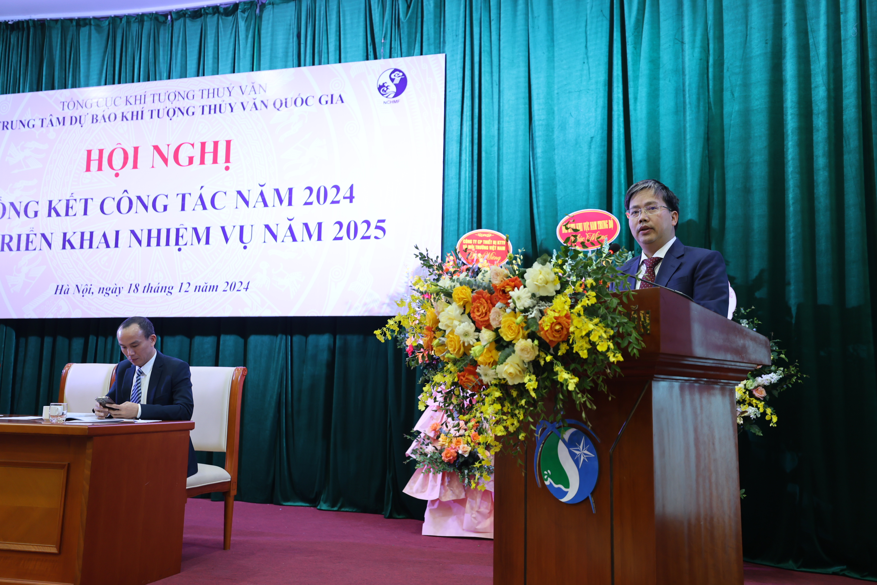
 Tổng cục Khí tượng Thủy văn vừa ban hành Quyết định số 1532/QĐ-TCKTTV về Kế hoạch “Phổ biến, giáo dục pháp luật và truyền thông chính sách có tác động lớn đến xã hội trong quá trình xây dựng văn bản quy phạm pháp luật về khí tượng thủy văn năm 2025”
.jpg)
.jpg)

.jpg)
.jpg)